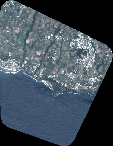
TYPE:
SENSOR
LAYER:
DS_PHR1A_202501030634029_FR1_PX_E055S22_0716_00584
FORMAT:
DIMAP
RASTER:
image/tiff
General Information
Map Name
Geometric Processing Level
Radiometric Processing Level
BASIC
Image dimensions
Number of columns
2452
Number of rows
3175
Number of spectral bands
4
Dataset framing
Vertice
Longitude (DEG)
Latitude (DEG)
Row
Col
#1
55.52725360181748
-21.33510502216947
1
#2
55.57588045415767
-21.33605517539837
#3
55.57562498428223
-21.39444429711811
#4
55.52705924728247
-21.39408507511014
Dataset sources
PHR
Coordinate Reference System
Projected Coordinate System
Geocoding tables identification
EPSG(6.3)
Production
Production Date
2025-01-04T11:50:19.231
Job identification
7219114101-2
Dataset Producer Identification
AIRBUS DS GEO
Producer link
http://www.geo-airbusds.com
Quicklook
Copyright