TYPE:
SENSOR
LAYER:
DS_PHR1A_202206190629378_FR1_PX_E055S22_0924_00747
FORMAT:
DIMAP
RASTER:
image/jp2
General Information
Map Name
Geometric Processing Level
Radiometric Processing Level
BASIC
Image dimensions
Number of columns
1932
Number of rows
4073
Number of spectral bands
4
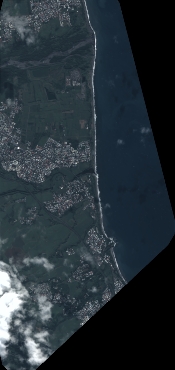
Dataset framing
Vertice
Longitude (DEG)
Latitude (DEG)
Row
Col
#1
55.67956396115552
-20.9698462654642
1
#2
55.71839868954274
-20.97047315186876
#3
55.71845391164489
-21.04551804927475
#4
55.67987291785168
-21.04506443475464
Dataset sources
PHR
Coordinate Reference System
Projected Coordinate System
Geocoding tables identification
EPSG(6.3)
Production
Production Date
2022-06-20T14:08:47.190
Job identification
6400491101-2
Dataset Producer Identification
AIRBUS DS GEO
Producer link
http://www.geo-airbusds.com
Quicklook
Copyright