TYPE:
SENSOR
LAYER:
DS_PHR1B_202107150637279_FR1_PX_E055S22_0819_00361
FORMAT:
DIMAP
RASTER:
image/jp2
General Information
Map Name
Geometric Processing Level
Radiometric Processing Level
BASIC
Image dimensions
Number of columns
3143
Number of rows
1891
Number of spectral bands
4
Dataset framing
Vertice
Longitude (DEG)
Latitude (DEG)
Row
Col
#1
55.59213931579048
-21.36307554865485
1
#2
55.65341217087634
-21.36293439192427
#3
55.65363753373747
-21.39699753174394
#4
55.59230818655072
-21.39711499661258
Dataset sources
PHR
Coordinate Reference System
Projected Coordinate System
Geocoding tables identification
EPSG(6.3)
Production
Production Date
2021-07-20T23:34:19.877
Job identification
5848223101-2
Dataset Producer Identification
AIRBUS DS GEO
Producer link
http://www.geo-airbusds.com
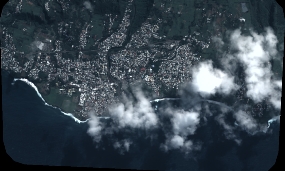
Quicklook
Copyright