TYPE:
SENSOR
LAYER:
DS_PHR1B_202107150637490_FR1_PX_E055S22_0819_00363
FORMAT:
DIMAP
RASTER:
image/jp2
General Information
Map Name
Geometric Processing Level
Radiometric Processing Level
BASIC
Image dimensions
Number of columns
3023
Number of rows
1903
Number of spectral bands
4
Dataset framing
Vertice
Longitude (DEG)
Latitude (DEG)
Row
Col
#1
55.59213454293936
-21.36277713498163
1
#2
55.65338008170158
-21.36097375719859
#3
55.65368767216138
-21.39697127320213
#4
55.59237422805759
-21.39875900597369
Dataset sources
PHR
Coordinate Reference System
Projected Coordinate System
Geocoding tables identification
EPSG(6.3)
Production
Production Date
2021-07-20T23:34:46.610
Job identification
5848222101-2
Dataset Producer Identification
AIRBUS DS GEO
Producer link
http://www.geo-airbusds.com
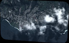
Quicklook
Copyright