TYPE:
SENSOR
LAYER:
DS_PHR1B_202107150636592_FR1_PX_E055S22_0819_00353
FORMAT:
DIMAP
RASTER:
image/jp2
General Information
Map Name
Geometric Processing Level
Radiometric Processing Level
BASIC
Image dimensions
Number of columns
12286
Number of rows
7286
Number of spectral bands
1
Dataset framing
Vertice
Longitude (DEG)
Latitude (DEG)
Row
Col
#1
55.59217561814803
-21.36203301452349
#2
55.65344380210392
-21.36222039507681
#3
55.65354176367914
-21.39776660325699
#4
55.59222125129854
-21.39755893905424
Dataset sources
PHR
Coordinate Reference System
Projected Coordinate System
Geocoding tables identification
EPSG(6.3)
Production
Production Date
2021-07-20T23:37:22.650
Job identification
5848221101-1
Dataset Producer Identification
AIRBUS DS GEO
Producer link
http://www.geo-airbusds.com
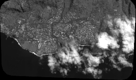
Quicklook
Copyright