TYPE:
SENSOR
LAYER:
DS_PHR1B_202107150636592_FR1_PX_E055S22_0819_00353
FORMAT:
DIMAP
RASTER:
image/jp2
General Information
Map Name
Geometric Processing Level
Radiometric Processing Level
BASIC
Image dimensions
Number of columns
3072
Number of rows
1822
Number of spectral bands
4
Dataset framing
Vertice
Longitude (DEG)
Latitude (DEG)
Row
Col
#1
55.59217812017017
-21.36204021543319
1
#2
55.65344133656401
-21.36222776140181
#3
55.65353927505487
-21.3977689904513
#4
55.59222375337619
-21.39756134228688
Dataset sources
PHR
Coordinate Reference System
Projected Coordinate System
Geocoding tables identification
EPSG(6.3)
Production
Production Date
2021-07-20T23:35:15.523
Job identification
5848221101-2
Dataset Producer Identification
AIRBUS DS GEO
Producer link
http://www.geo-airbusds.com
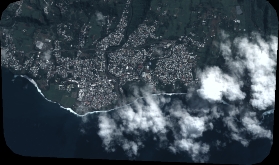
Quicklook
Copyright