TYPE:
SENSOR
LAYER:
DS_PHR1A_201809150640472_FR1_PX_E055S22_0919_00998
FORMAT:
DIMAP
RASTER:
image/jp2
General Information
Map Name
Geometric Processing Level
Radiometric Processing Level
BASIC
Image dimensions
Number of columns
7027
Number of rows
5504
Number of spectral bands
4
Dataset framing
Vertice
Longitude (DEG)
Latitude (DEG)
Row
Col
#1
55.67326135057374
-21.19753845231028
1
#2
55.82152246222213
-21.19613670865293
#3
55.82191266851575
-21.29779114937331
#4
55.67360745762804
-21.2986358757638
Dataset sources
PHR
Coordinate Reference System
Projected Coordinate System
Geocoding tables identification
EPSG(6.3)
Production
Production Date
2018-10-04T18:00:55.954
Job identification
3349198101-2
Dataset Producer Identification
AIRBUS DS GEO
Producer link
http://www.geo-airbusds.com
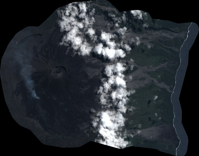
Quicklook
Copyright